Granby’s expansion from a modest textile-mill town along the Yamaska River into a major industrial and residential hub in the Eastern Townships has pushed development onto increasingly complex terrain. The gentle valley walls that frame the city, underlain by variable glacial till, Champlain Sea silts, and occasional bedrock outcrops, demand rigorous slope stability analysis before any cut or fill operation. Our team has worked extensively across Granby’s zoning sectors, from the steep embankments near Lac Boivin to the commercial corridors along Route 139, characterizing the shear strength of sensitive clay-silt sequences that lose structure when disturbed. For urban projects where excavation geometry is constrained, we often integrate the findings with deep excavation monitoring to validate design assumptions during construction staging.
A factor of safety of 1.3 for temporary cuts during Granby’s winter freeze-thaw cycles is not conservative enough — we target 1.5 minimum on all permanent slopes per NBCC 2015 requirements.
Methodology applied in Granby Quebec
Risks and considerations in Granby Quebec
The standard setup for a slope stability investigation in Granby starts with a truck-mounted CME-75 drill rig, equipped with HQ3 wireline tooling to recover continuous core through the overburden and at least 3 meters into competent bedrock. We install nested vibrating-wire piezometers at multiple depths within the borehole to capture the seasonal perched water tables that develop above the low-permeability Champlain clays. The drillers log every run for recovery ratio and note any zones of gravel or cobbles that might represent a paleochannel of the Yamaska River — a critical detail if the slope design relies on a drainage blanket intercepting groundwater flow. In late autumn, when Granby’s groundwater levels peak, we often return to the site for a second set of pore pressure readings to confirm the worst-case phreatic surface used in the stability model.
Our services
Every Granby site presents a unique stratigraphic signature, so our stability assessments are never a one-size-fits-all exercise. We structure the work into two principal phases, from field data acquisition through to final design recommendations.
Limit Equilibrium Stability Modeling
We build 2D cross-sections from borehole logs and LiDAR topographic surveys, then run circular and non-circular slip surface searches using Spencer and Morgenstern-Price formulations. Each model incorporates layered shear strengths, pore pressure grids from piezometer data, and pseudo-static seismic coefficients drawn directly from NBCC 2015 site-specific spectra for Granby’s latitude and soil class. Output includes the critical failure surface, a deterministic factor of safety, and a sensitivity analysis isolating the effect of toe erosion along the Yamaska River during flood events.
Remedial and Reinforcement Design
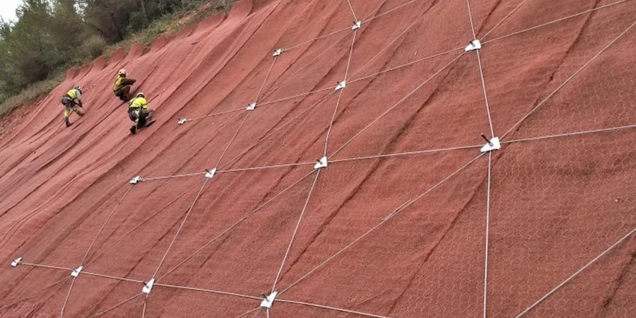
When existing slopes in older Granby neighborhoods show signs of distress — tension cracks, leaning retaining walls, or seepage at the toe — we design stabilization measures suited to the tight access typical of residential lots. Solutions range from soil nail arrays with shotcrete facing to mechanically stabilized earth (MSE) berms that reclaim usable yard space. We prepare IFC drawing sets with reinforcement schedules, drainage details, and a construction sequencing plan that respects Granby’s noise by-law restrictions during the excavation and drilling phases.
Quick answers
What role does the Yamaska River play in slope stability around Granby?
The Yamaska River and its tributaries control the base level for groundwater discharge across much of Granby. During spring freshet, river levels can rise by over 2 meters, saturating the toe of nearby slopes and reducing effective stress. Our models use high-water marks from the CEHQ hydrometric station records to define a conservative downstream boundary condition, and we factor in toe scour when calculating the long-term factor of safety.
Which laboratory tests are essential for a reliable slope stability analysis in Granby's soils?
For the Champlain Sea silts and clays that dominate Granby’s valley walls, we prioritize consolidated-undrained (CIU) triaxial tests with pore pressure measurement per ASTM D4767. These give us the effective stress friction angle and cohesion intercept needed for drained and undrained limit equilibrium runs. We supplement with Atterberg limits to confirm the clay fraction and activity, and direct shear tests on any granular till layers to define the Mohr-Coulomb envelope for those strata.
How much does a slope stability analysis cost for a residential lot in Granby?
Does Granby require a slope stability report for building permit applications near steeper terrain?
The Ville de Granby’s urban planning department generally requires a geotechnical report, including a slope stability assessment, for any construction within a setback zone adjacent to slopes steeper than 20 percent, or where the proposed footing excavation exceeds 1.2 meters in depth. The report must be stamped by a Professional Engineer registered with the Ordre des ingénieurs du Québec and must demonstrate compliance with the minimum safety factors outlined in the current NBCC.